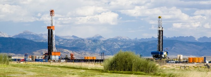
The Department of the Interior today announced the release of a new U.S. Geological Survey assessment identifying significant undiscovered, technically recoverable oil and gas resources in the Mowry Composite Total Petroleum System. Spanning parts of Wyoming, Colorado and Utah, the assessment estimates the presence of 473 million barrels of oil and 27 trillion cubic feet of natural gas—resources that could help bolster domestic energy supply and fuel local economies.
“This new USGS assessment underscores the role of American energy resources in strengthening our energy independence and driving economic development across the West,” said Secretary of the Interior Doug Burgum. “Public lands in Southwestern Wyoming hold significant potential, and this science-based evaluation provides critical data to help inform responsible resource management. We Map, Baby, Map to provide updated estimates of recoverable oil and gas and equip decision-makers, communities, and industry with the knowledge they need to support job creation, domestic energy production, and long-term economic growth.”
Since exploration began in the 1950s, the Mowry Composite system, which includes the Dakota Sandstone, the Muddy Sandstone, the Mowry Shale, and the Frontier Formation, has produced approximately 7.3 trillion cubic feet of natural gas, as much gas as the U.S. consumes in three months at the current rate of consumption, and 90 million barrels of oil, or four days’ supply for the nation.
“USGS energy assessments typically focus on undiscovered resources – areas where science tells us there may be a resource that industry hasn’t discovered yet,” said Acting USGS Director Sarah Ryker. “In this case, our assessment found substantial undiscovered, technically recoverable oil and gas resources.”
Today’s assessment includes the Mowry Composite Total Petroleum System, a geologic grouping in southwestern Wyoming and parts of Colorado and Utah containing deposits of a shallow, prehistoric ocean which covered most of the Rocky Mountain region. The USGS previously assessed undiscovered energy resources in the area in 2005. The Southwestern Wyoming Geologic Province, where the Mowry is located, also produces abundant additional oil and gas from other formations, such as the Lance Formation, Lewis Shale, and the Mesa Verde Group, none of which are accounted for in today’s assessment.
USGS oil and gas assessments began 50 years ago following an oil embargo against the U.S. that signaled a need to understand the occurrence, distribution and potential volumes of undiscovered resources. The embargo led to a mandate for the USGS to use geologic science and data to assess undiscovered oil and gas resources to help meet the nation’s needs. The work continues today – identifying new resources for domestic production as well as international resources that affect market conditions — an important part of the USGS mission to provide actionable insight to U.S. leaders, other Federal agencies, industry and the public.
USGS energy resource assessments provide information to policy makers on resource potential in areas of the U.S. and the world. For land-management agencies such as the Bureau of Land Management, the results of an energy resources assessment feed into land-use and resource management plans. For the private sector, USGS assessments of undiscovered energy resources provide context for planning detailed exploration.
The range of assessments produced has changed with the technology available to produce oil. In 1995, the USGS began conducting assessments of unconventional, technically recoverable resources.

